The Map of the World: The Absent Truth of the Mercator Projection
خريطة العالم: الحقيقة الغائبة
Greenland asks the map why it looks as big as a continent, and Africa asks only to be seen at its real size.
بقلم المهندس المعماري عماد درويش5 دقائق قراءة
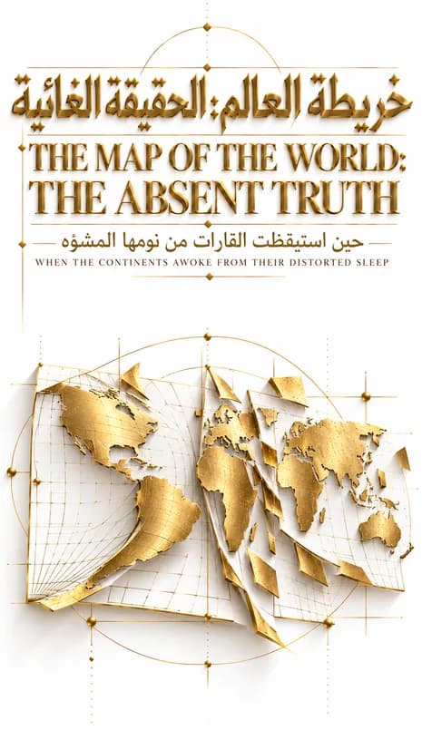
The Mercator projection, presented by the Flemish mapmaker Gerardus Mercator in 1569 for navigation at sea, enlarges land the farther it lies from the equator, so Greenland looks as large as Africa although Africa is about fourteen times bigger. In Imad's story the old map, the continents and science argue over the true size of Africa, after France said in September 2026 that its diplomacy would drop the Mercator map.
تنويهDISCLAIMERتستند هذه القصة إلى إعلان فرنسا، الجمعة 4 سبتمبر 2026، التخلي عن إسقاط ميركاتور كخريطة رسمية، ضمن حركة دولية تقودها مطالبات الاتحاد الأفريقي.This story is based on France's announcement, on Friday, September 4, 2026, that it would abandon the Mercator projection as its official map, part of an international movement led by African Union demands.وضع عالم الخرائط الفلمنكي جيراردوس ميركاتور هذا الإسقاط في القرن السادس عشر لتسهيل الملاحة البحرية.The Flemish cartographer Gerardus Mercator devised this projection in the sixteenth century to ease maritime navigation.أما الشخصيات الرمزية والحوارات الواردة هنا (الخريطة، القارات، خط الاستواء) فهي معالجة أدبية متخيلة، ولا تُنسب فيها أي أقوال مباشرة إلى ميركاتور نفسه أو إلى أي شخصية تاريخية حقيقية.
The symbolic characters and dialogue presented here (the Map, the Continents, the Equator) are an imaginative literary treatment, and no direct words are attributed to Mercator himself or to any real historical figure.
منذ القرن السادس عشر، عاشت الخريطة على الجدران.Since the sixteenth century, the map had lived on walls.في المدارس.In schools.وفي قاعات القرار.In halls of decision.وفي أذهان أطفال لم يسألوا يومًا: هل ما أراه حقيقي؟And in the minds of children who never once asked: is what I see real?كانت الخريطة قد وُلدت من حاجة بحّار.The map had been born from a sailor's need.أراد خطًا مستقيمًا يقوده عبر المحيط دون أن يضل.He wanted a straight line to guide him across the ocean without losing his way.فوُلد إسقاط يحوّل كرة الأرض إلى سطح مستوٍ.So a projection was born that turned the sphere of the Earth into a flat surface.لكن الاستقامة التي أراحت السفن، أربكت الحقيقة.
But the straightness that eased the ships confused the truth.كلما ابتعدت الأرض عن خط الاستواء، انتفخت على الورق أكثر مما هي عليه في الواقع.The farther land lay from the equator, the more it swelled on paper beyond its true size.وكلما اقتربت من خط الاستواء، انكمشت على الورق أصغر مما تستحق.And the closer it lay to the equator, the smaller it shrank on paper below what it deserved.هكذا، نامت القارات الاستوائية لقرون داخل صورة أصغر من حقيقتها.Thus, the equatorial continents slept for centuries inside an image smaller than their truth.سألت غرينلاند الخريطة يومًا:Greenland once asked the Map:لماذا أبدو بحجم قارة كاملة؟Why do I appear the size of an entire continent?فأجابت الخريطة بصمت.The Map answered only with silence.لأنها لم تكن تكذب عمدًا.For it had not lied on purpose.كانت فقط تحمل عيبًا هندسيًا لم يصلحه أحد.It simply carried a geometric flaw that no one had corrected.غرينلاند التي لا تتجاوز مساحتها جزءًا يسيرًا من مساحة أفريقيا، بدت على الورق شبيهة بها في الحجم.Greenland, whose area amounts to only a small fraction of Africa's, appeared on paper to rival it in size.
بينما أفريقيا، بقاراتها وصحاريها وغاباتها وشعوبها، بقيت محاصرة داخل مربع أصغر مما تستحقه أرضها.While Africa, with its nations, deserts, forests, and peoples, remained confined within a square smaller than its land deserved.
لم يكن هذا خطأ بريئًا وحسب.This was not merely an innocent error.
فحين تتكرر الصورة نفسها لقرون، تتحول إلى فكرة راسخة في الذهن.For when the same image repeats for centuries, it hardens into a fixed idea in the mind.
صورة تقول من دون كلمات: أن الشمال أكبر.An image that says without words: the North is larger.
وأن الجنوب أصغر مما هو عليه.And the South is smaller than it truly is.
وقفت أفريقيا، عبر أصوات أبنائها المجتمعين تحت اسم الاتحاد الأفريقي، تطالب بتصحيح لم يعد يحتمل التأجيل.Africa stood, through the voices of its people gathered under the African Union, demanding a correction that could no longer be postponed.
لم تطلب أرضًا جديدة.It did not ask for new land.
طلبت فقط أن تُرى على حقيقتها.It asked only to be seen as it truly was.
في الجمعة الرابع من سبتمبر 2026، أعلنت فرنسا تخليها عن الخريطة القديمة.On Friday, September 4, 2026, France announced it would abandon the old map.
لم يكن القرار عن كراهية للماضي.The decision was not born of hatred for the past.
بل عن رغبة في تصويب ما طال السكوت عنه.But of a desire to correct what silence had shielded for too long.
وقفت خرائط جديدة تُظهر أفريقيا بحجمها الحقيقي.New maps stood displaying Africa at its true size.
وأمريكا الجنوبية ممتدة كما هي فعلًا، لا كظل صغير بجانب الشمال.And South America stretching as it truly was, not as a small shadow beside the North.
بينما تراجعت في الصورة دول اعتادت أن تحتل مساحة أكبر من واقعها.While nations once accustomed to occupying more space than their reality now receded in the image.
سألت الخريطة الجديدة الخريطة القديمة:The new map asked the old one:
هل تخافين من الصغر؟Are you afraid of appearing smaller?
فأجابت القديمة، وهي تُطوى ببطء:The old map replied, as it was slowly folded away:
لم أكن أنا من اخترت حجمي.I did not choose my own size.
كنت فقط انعكاسًا لخطأ هندسي، صار بمرور الزمن أداة يستخدمها من يريد أن يرى نفسه أكبر مما هو عليه فعلًا.I was merely the reflection of a geometric flaw that, over time, became a tool for those who wished to see themselves larger than they truly were.
قال العلم، وهو يراقب من بعيد:Science, watching from a distance, seemed to say:
أنا لست أداة لتضخيم أحد على حساب أحد.I am not a tool for inflating one at the expense of another.
أنا مقياس.I am a measure.
وحين يُستخدم المقياس لخدمة فكرة بدل خدمة الحقيقة، يصبح هو نفسه بحاجة إلى تصحيح.And when a measure is used to serve an idea instead of the truth, it is the measure itself that needs correcting.
لم يكن التصويب سهلًا.The correction was not easy.
فالصورة التي عاشت في الأذهان لقرون لا تُمحى بقرار واحد.An image that had lived in minds for centuries cannot be erased by a single decision.
لكن كل خريطة جديدة تُعلَّق على جدار، هي خطوة نحو عالم يرى نفسه كما هو، لا كما أراد له الماضي أن يبدو.Yet every new map hung upon a wall is a step toward a world that sees itself as it is, not as the past wished it to appear.
هذه هي قوة العلم حين يعود إلى تصحيح نفسه.This is the power of science when it returns to correct itself.
أن يعترف بخطأ استمر قرونًا.To acknowledge an error that endured for centuries.
لا خجلًا من الماضي.Not out of shame for the past.
بل إيمانًا بأن الرجوع عن الخطأ فضيلة، لا ضعفًا.But out of conviction that reversing an error is a virtue, not a weakness.
وأن تصحيح خريطة، هو تصحيح لصورة عالم بأكمله في أذهان أجيال قادمة.And that correcting a map is correcting the image of an entire world in the minds of generations yet to come.
How a name or an image can shrink a place is also the subject of The Epic of the Name Ashamed of Its Language, and geometry is put on trial in The Epic of Pentagon Geometry. Both are in the ideas and philosophy collection.
بقلم
Architect Imad Darouich
المهندس المعماري عماد درويش
مهندس معماري وكاتب ومؤسس 3DEPICS، يقيم في نيويورك. يكتب أدبًا ملحميًا يعبر الحدود واللغات والجغرافيا، حيث تلتقي الفلسفة بالعمارة، والروحانية بالتاريخ، والذاكرة بالخيال.